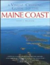
WHEN YOU NAVIGATE THE COAST OF MAINE, A PICTURE IS WORTH A THOUSAND WORDS A Visual Cruising Guide to the Maine Coast takes the guesswork out of navigating Maine s intricate, reef-strewn waters, ensuring that your next voyage through this coastal paradise will be picture-perfect. Inside you will find more than 180 full-color aerial photographs that provide "by-the-picture navigational guidance for Maine s treasured harbors, difficult passages, and hidden approaches. Author James Bildner has added chart segments and recommended course lines to these low-altitude photos, giving you a unique, at-a-glance guide to sailing around Maine. It s like cruising with a masthead lookout to point the way. Text descriptions of area with piloting instructions Labeled approach lines Low-angled photos with key navigation aides labeled Chart segments from high resolution NOAA charts

